Wednesday, January 16, 2008
Dealing with the Run of River issue
A website has been set up. Upper Pitt River primarily to put into one place all the information about the Upper Pitt River that is available.
Feel free to place your comments at the bottom of this post, or
E-Mail a message.
And also two other blogs Pitt River and one about Pitt Lake which will primarily be filled with the history, ecology and the issues that affect the Watershed.
Maps of the area
Maps that cover Burke-Pinecone Provincial Park, and surrounding areas. These maps are in 1: 50 000 scale, except for the geology maps.) These are all fast links to their Geoscan pages, from Natural Resources Canada, just click on “more”, which will open up a larger listing of options to the different map options, Geopdf are digitized pdf’s which allow you to customize the layers, and create your own maps. They all download in their own separate zip formatted folders, just open the folder and drag the map onto your desktop.
Vancouver North, Coquitlam, and Pitt Lake map Areas, British Columbia With Special Emphasis On the Evolution of the Plutonic Rocks; Roddick, J A. Geological Survey of Canada, Memoir 335, 1965, ; 276 pages.
( Three maps and three drawings are included in a zip file of the entire book. )
Port Coquitlam, BC , NRC. Canadian Topographic Maps 92G/7, (edition 7) 2009
Port Coquitlam, BC, NRC. Canadian Topographic Maps 92G/7, (edition 6) 2002
Geology Coquitlam, BC; Roddick, J A. Geological Survey of Canada, "A" Series Map 1153A , 1965
Pitt River, BC, NRC. Canadian Topographic Maps 92G/10, (edition 4) 2009
Pitt River, BC, NRC. Canadian Topographic Maps 92G/10, (edition 3) 2002
Geology Pitt Lake, Vancouver, East Half, BC; Roddick, J A; Armstrong, J E. Geological Survey of Canada, "A" Series Map 1151A , 1965
Mamquam Mountain, BC, NRC. Canadian Topographic Maps 92G/15, (edition 4) 2009
Mamquam Mountain, BC, NRC. Canadian Topographic Maps 92G/15, (edition 3) 2002
Stave River, BC, NRC. Canadian Topographic Maps 92G/9, (edition 5) 2009
Stave River, BC, NRC. Canadian Topographic Maps 92G/9, (edition 4) 2002
Glacier Lake, BC, NRC. Canadian Topographic Maps 92G/16, (edition 4) 2009
Glacier Lake, BC, NRC. Canadian Topographic Maps 92G/16, (edition 3) 2002
Squamish, BC, NRC. Canadian Topographic Maps 92G/11, (edition 4) 2009
Squamish, BC, NRC. Canadian Topographic Maps 92G/11, (edition 3) 2003
New Westminster, BC - Canada - United States of America, NRC. Canadian Topographic Maps 92G/2, (edition 7) 2009
New Westminster, BC - United States, NRC. Canadian Topographic Maps 92G/2, (edition 6) 2003
East Corbold Creek photos
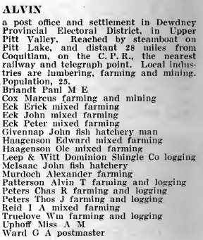
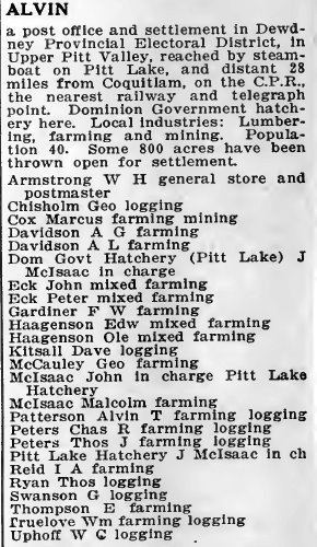
Alvin 1918
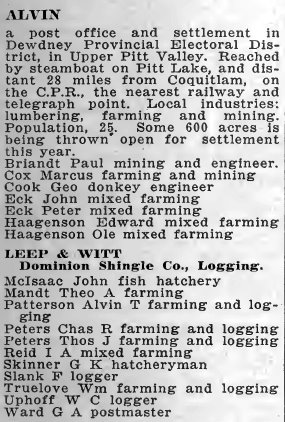
Alvin 1919
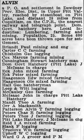
Alvin 1920
Alvin 1921
Alvin 1922
No comments:
Post a Comment