From the Vancouver Sun: Convicted guide outfitter allowed to continue operating in B.C.
Abe Dougan has 20-year ban from hunting and guiding in Yukon.
A sane person would hope that the conviction and sentencing in this case, would also automatically trigger censure in Canada, apparently Not.
Forty-three is a considerable amount of black bears to lose from this area ( mis-management unit ) and this is just ONE guide. No mention of the other guides, and just regular hunters and what they removed.
Saturday, March 14, 2015
Saturday, January 17, 2015
Short videos
I came across a few short videos, the longest being about 15 minutes in length, all created by Nick Didlick Photography
The fishing bears of the Pitt river
Grizzly Bears in the Pitt River Valley
Fishing with Sven
Where the Wild Fish Live
Pitt River Aerial Tour this is the longest video, it takes you by helicopter from the mouth of the Upper Pitt River, all the way along the river to the boundary with Garibaldi Provincial park.
Cheers
Subscribe to:
Posts (Atom)
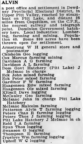
Alvin 1918
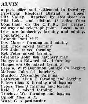
Alvin 1919
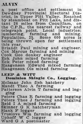
Alvin 1920
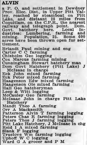
Alvin 1921
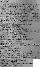
Alvin 1922