A few selected maps and one report, all relating in some way to the Pitt River Watershed.
Landscape units
Widgeon (PDF); Pitt (PDF); Alouette (PDF); Stave Lake area (PDF)
Legal Descriptions
Pitt to Harrison Lake (PDF); Harrison Lake to the Fraser River (PDF)
Historic Licensee operating areas ( Chilliwack Forestry District ) (PDF)
Lower Fraser Sustainable Resource Management Plan, SRMP (54 pages) 2013 (PDF)
Radio Channels being used up to 26 November 2015 (PDF)
Old Growth Managment in the Chilliwack Forestry District (PDF)
Squamish Foresty District
Squamish Operating tenures (PDF)
Old Growth Squamish Forestry District (PDF)
Squamish Forestry District Bridge Locations (PDF)
And a few images in a not so common format, from the Lands Office. Both are of the Upper Pitt River, and show some of the premptions. You will need to have one of the appropriate converters installed since they are both in MrSID format ( Download Screen ) PNWS02Tr07 and PNWS27Tr01
NOTE: If any of these links do not work, please email me, and I will host the documents elsewhere.
The links are all to the FTP sites of the Chilliwack and Squamish Forestry Districts
Monday, January 4, 2016
Subscribe to:
Posts (Atom)
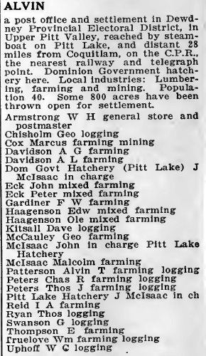
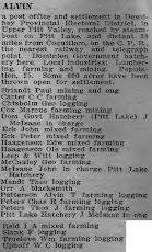
Alvin 1918
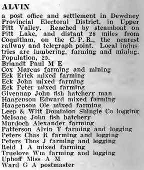
Alvin 1919
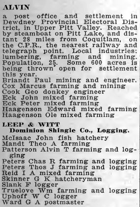
Alvin 1920
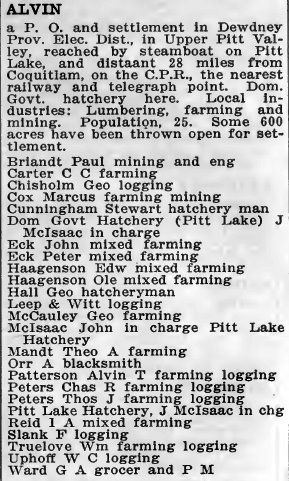
Alvin 1921
Alvin 1922